Carte Reduite Des Costes Orientales De L'Amerique Septentrionale . . . contenant L'Isle Royale . . . La Nouvelle Angleterre et la Nouvelle Yorc . . . MDCCLVII [with Plan of Boston Harbor]

Carte Reduite Des Costes Orientales De L'Amerique Septentrionale . . . contenant L'Isle Royale . . . La Nouvelle Angleterre et la Nouvelle Yorc . . . MDCCLVII [with Plan of Boston Harbor]
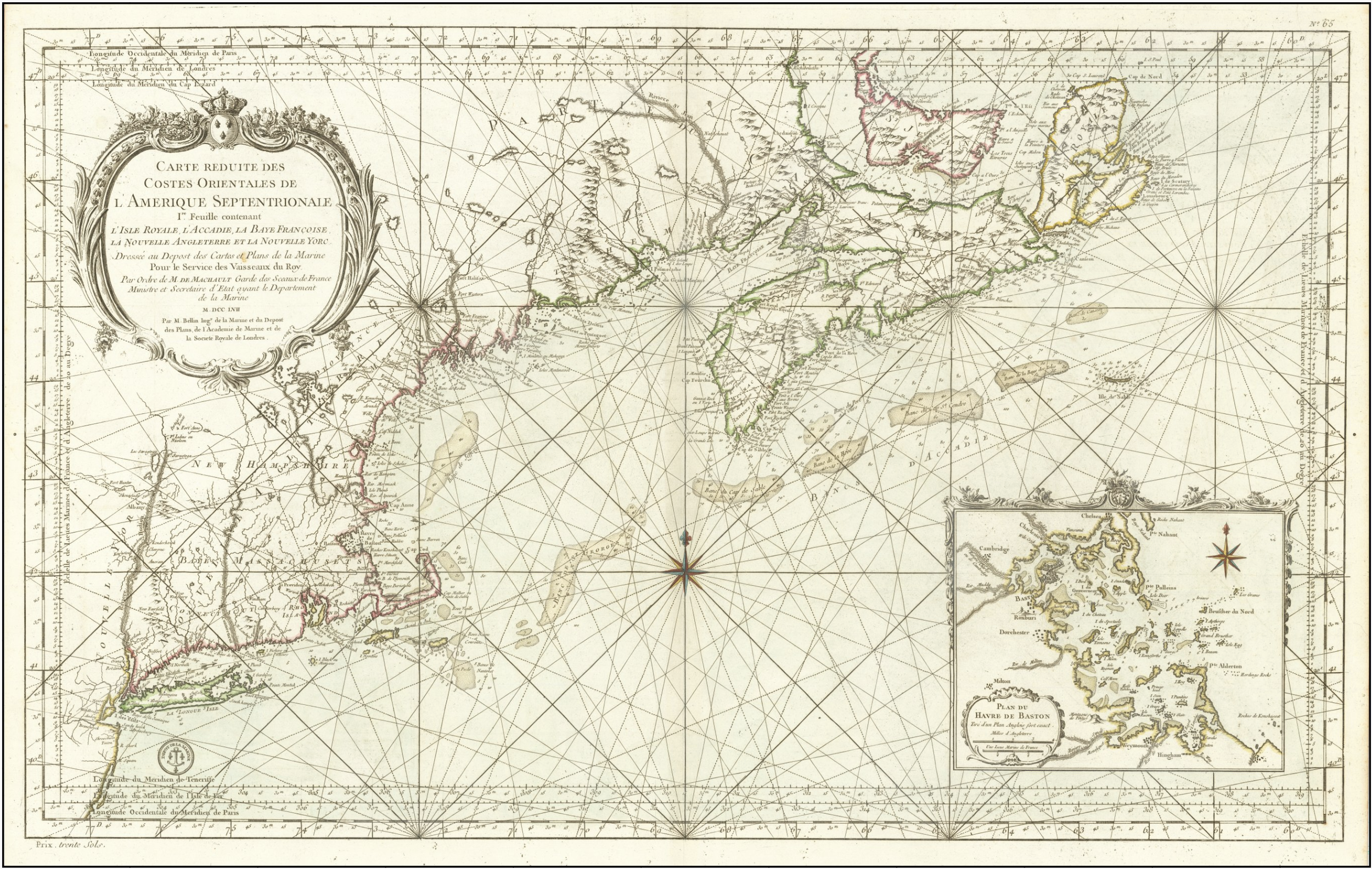
First State -- French & Indian War Era Sea Chart of the area from Long Island to Newfoundland with a Large Plan of Boston Harbor Striking example of the first state of Bellin's large chart of the East Coast, from south of Long Island to Isle Royale, with a detailed inset of Boston Harbor.
The chart extends to west of the Hudson, showing Fort Hunter on the Mohoch River. Excellent detail throughout New York, Connecticut, Rhode Island, Massachusetts, New Hampshire, Vermont and the Province de Terre Main, as well as throughout the Canadian regions of the map. Hundreds of place names, soundings, rivers, islands, shoals, banks, ports, bays, etc. The coastal detail and detail along the rivers is truly remarkable. Includes a very large inset of Boston Harbor and Vicinity, again with soundings, islands, and at least 30 placenames, a cartouche and a compass rose. Includes a striking large cartouche, compass rose, rhumb lines and other decorative features.
The true first state of this important Depot De La Marine Chart, distinguishable by the lack of rhumb lines in the Boston inset. One of the best general New England coastal charts of the French & Indian War period, which is now quite scarce on the market.
This map was a custom order. Found, framed, and shipped according to customer specifications.